
Whenever you make a map, remember that you are communicating something to some person or community. Maps are always meant to show location of a certain phenomenon e.g distance, disease infestation, deaths, droughts e.t.c.

There fore your communication should always depict the intended objective.Below are the components your map should not miss.

A tittle gives the map reader what information is represented and to which extent.
For example: "A map showing tourist attractions in Uganda"
The title should always be kept precise and on point.
Orientation
For example: "A map showing tourist attractions in Uganda"
The title should always be kept precise and on point.
Orientation

It defines the direction in which the map objects are oriented. It is always represented as a compass symbol pointing in a given direction.
However small it may be never forget to include that symbol.
Date
Date

Dates may be into two forms i.e date of map making (Dom) and date of data collection (Doc).
Most of the times it's only the Dom that is represented on maps since it helps to show how old the map has been in existence. This is necessary because alot of changes happen every day mostly in Urban areas.
On the other hand Doc helps to show the map user the age of the data used.
While representing features like wetlands, schools,hospitals, it is advisable to use recent layers.
Legend.
On the other hand Doc helps to show the map user the age of the data used.
While representing features like wetlands, schools,hospitals, it is advisable to use recent layers.
Legend.

A legend is a key that describes the symbols you have used on your map.
This helps to easily identify features.
However you should have it in mind to use standard color and symbols for easy identification.
Please never interchange symbols.
Author
 Every time a map is made never forget to include the person or organization responsible. In case any one has a query regarding the map, they will always no the right person or organization to approach.
You never know it may also earn you an opportunity in future.
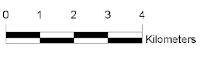
Scale
 \
\
Scale will always help someone retrieving distance information on your map.
You should always choose a convenient scale depending on the size of the area.
The larger the area the smaller the scale and vice versa.
Remember that scale determines the details to present.
For a small scale, a lot of generalization is done to represent features than on a large scale
Grids
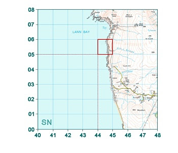
It is not a must to include grids on every map.
To some maps they are important while to others they are not.
Grids are always important more so when the map is used as a guide to retrieve coordinate information.
This applies to mineral maps, cadastral maps e.t.c
Disclaimer
 As a professional you should always leave room in case of an error. Errors can arise from misrepresentation, data collection e.t.c
Never leave room for custodianship of an error resulting from use of your map.
Always include small disclaimer statements.
Meta data.
 As its definition is, it is data about data.
This includes the coordinate system,false coordinate information, time and dates, history of the data and any other relevant info you would like to pass on.
In conclusion, you can add any other elements not included here but these are a must have.
This helps to easily identify features.
However you should have it in mind to use standard color and symbols for easy identification.
Please never interchange symbols.
Author

You never know it may also earn you an opportunity in future.
Scale
 \
\Scale will always help someone retrieving distance information on your map.
You should always choose a convenient scale depending on the size of the area.
The larger the area the smaller the scale and vice versa.
Remember that scale determines the details to present.
For a small scale, a lot of generalization is done to represent features than on a large scale
Grids

It is not a must to include grids on every map.
To some maps they are important while to others they are not.
Grids are always important more so when the map is used as a guide to retrieve coordinate information.
This applies to mineral maps, cadastral maps e.t.c
Disclaimer

Never leave room for custodianship of an error resulting from use of your map.
Always include small disclaimer statements.
Meta data.

This includes the coordinate system,false coordinate information, time and dates, history of the data and any other relevant info you would like to pass on.
In conclusion, you can add any other elements not included here but these are a must have.

![QGIS Georeferencing [Tutorial]](https://blogger.googleusercontent.com/img/b/R29vZ2xl/AVvXsEjc9sq2qo8xv4uKC-9P4l8_T0Xr6L7HS2yf2jjcZigHKve-J-c4aFb6U2h1ujYPZkIlZc1ejAuK_1Wk3MmQBQSzDmPIy1v4BhN0HgJ8S0n3U9PMZtm7PRE-eO1adeR_Qa25ghApjRgfZvw/w72-h72-p-k-no-nu/uganda_se_1964.jpg)
