
Before looking into Georeferencing, allow me introduce you to Atom Map Solutions, a service that was developed to make for you maps at a fair price, you simply have to visit Atom Map Solutions page to make your order
In case of anything kindly contact us through our email.
Don't forget to also follow us on facebook.
Georeferencing
Georeferencing refers to the assigning of ground ( real ) coordinates to an object. In spatial representations, objects as buildings, trees, roads, heights, temperature are represented using a given set of coordinates (x,y,z). Georeferencing helps to make sure that such objects are located in their right space.
Suppose you need to use an old map in a spatial analysis project in QGIS and this map is only available in paper format. You need to convert it from analog to digital form either through scanning or taking a picture of that map using your smart phone.
 |
| Scanned map of central Uganda |
However, when you import this image in a GIS environment, it will be lacking spatial location. Today we will look straight on how to attach spatial info on that image. In this tutorial we will use a map of Uganda. click here to download the map CRS - UTM ARC1960 36N
Step 1: Import the image in QGIS. Study the image to identify the coordinate system , gid location and other attribute information necessary for Georeferencing

Step 2: Open the plugin tool and activate the GDAL Georeferencing tool.

Step 3: Open the Georeferencing tab( Raster-> georeferencing). Import the image in this window

Step 4: Open transformation settings and set the parameters you would like to use in the transformation, coordinate system and also specify where to save your new image after geo referencing
Step 5: Zoom to a particular area and add well distributed control points ( in this tutorial we shall use only four). after adding all the points, click start georeferencing( the green play button)

 |
| coordinates used in Georeferencing |
Step 6. Close the Georeferencing tool and import the saved image in QGIS. Set the project coordinate system as coordinate system of the map.
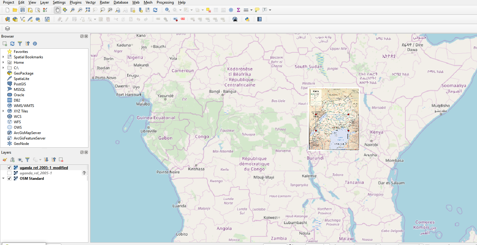
Finally add a base map to check whether your image lies in the
correct geographical location as shown below.
Kindly like our facebook page @atomgeospatialsolutions to keep you updated about the latest Geospatial info

![QGIS Georeferencing [Tutorial]](https://blogger.googleusercontent.com/img/b/R29vZ2xl/AVvXsEjc9sq2qo8xv4uKC-9P4l8_T0Xr6L7HS2yf2jjcZigHKve-J-c4aFb6U2h1ujYPZkIlZc1ejAuK_1Wk3MmQBQSzDmPIy1v4BhN0HgJ8S0n3U9PMZtm7PRE-eO1adeR_Qa25ghApjRgfZvw/w72-h72-p-k-no-nu/uganda_se_1964.jpg)
